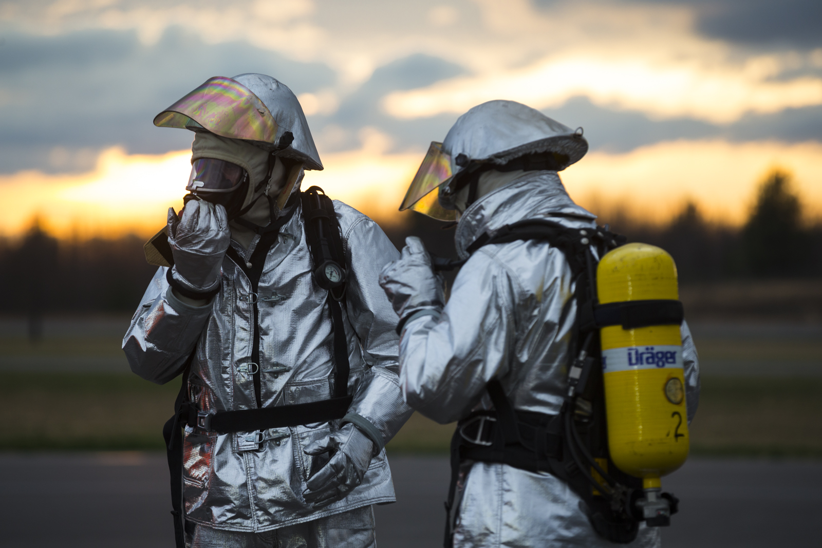
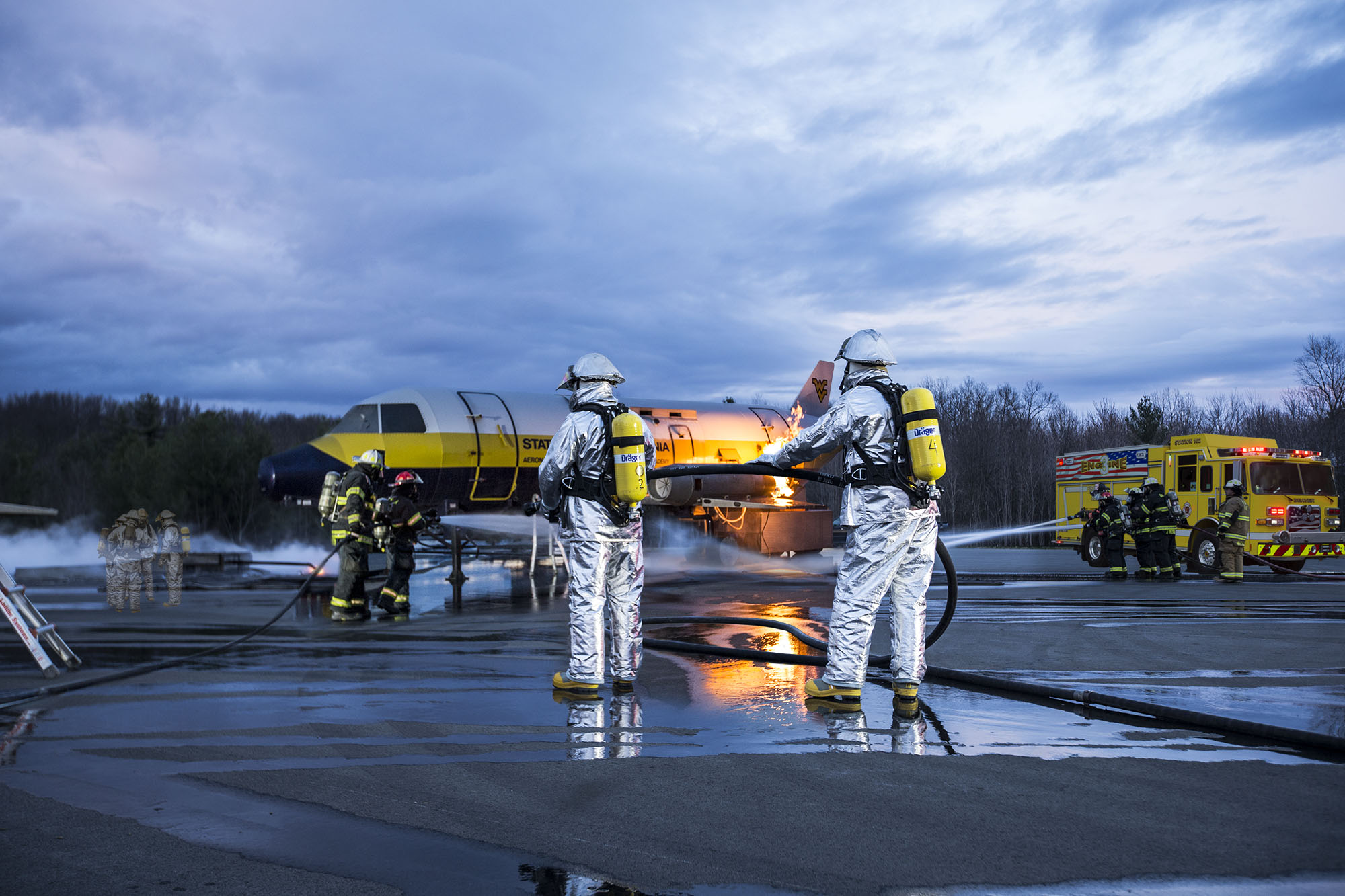
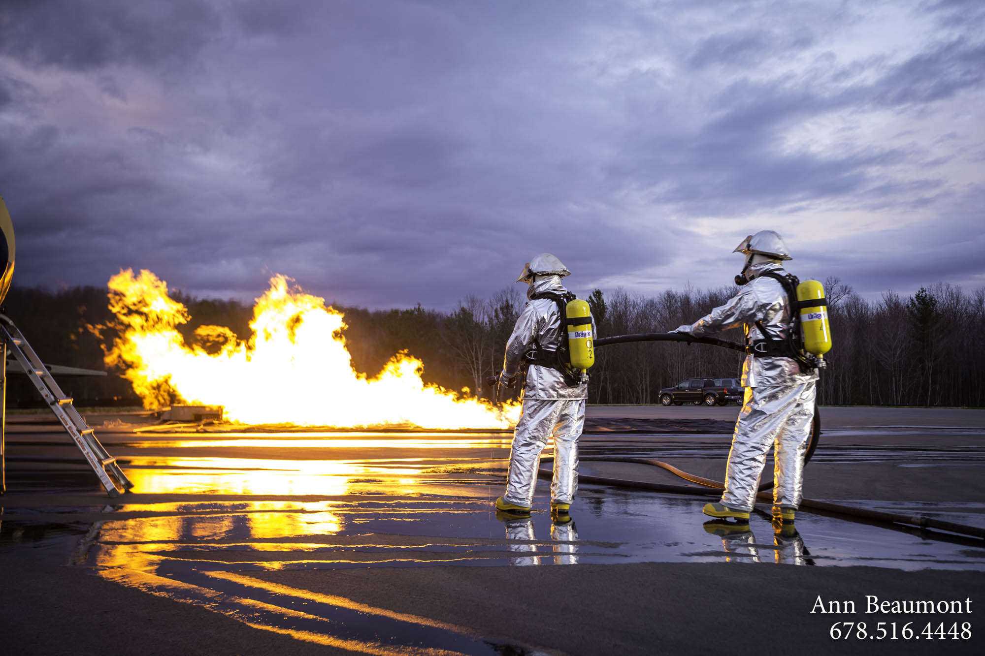
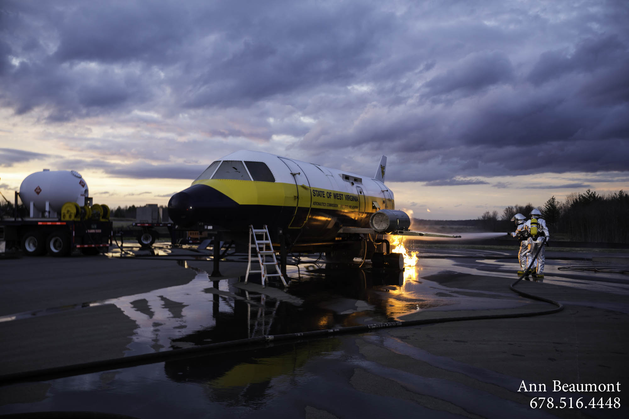
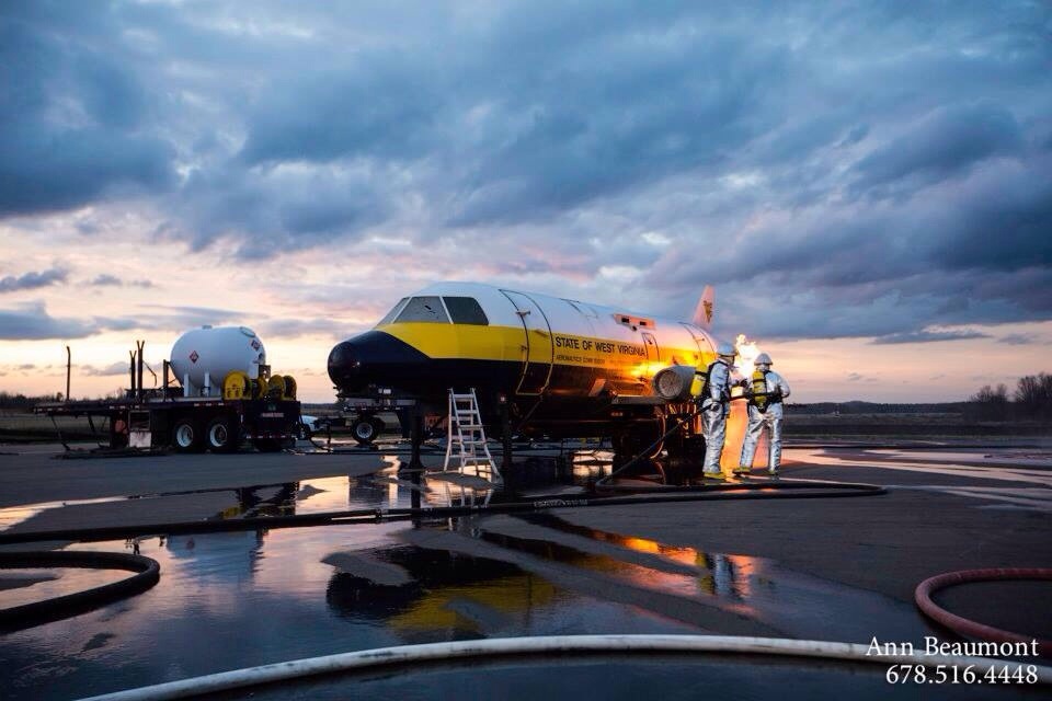
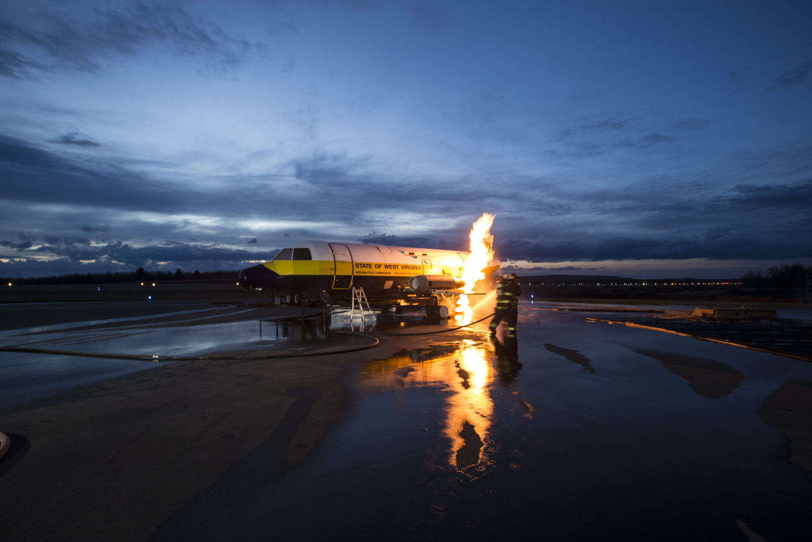
Fire and Rain
Who wouldn't want to watch people in silver suits extinguish flames on an aircraft?Look at that beautiful sky. Further editing is in progress.
More on this as the week progresses.


Who wouldn't want to watch people in silver suits extinguish flames on an aircraft?Look at that beautiful sky. Further editing is in progress.
More on this as the week progresses.
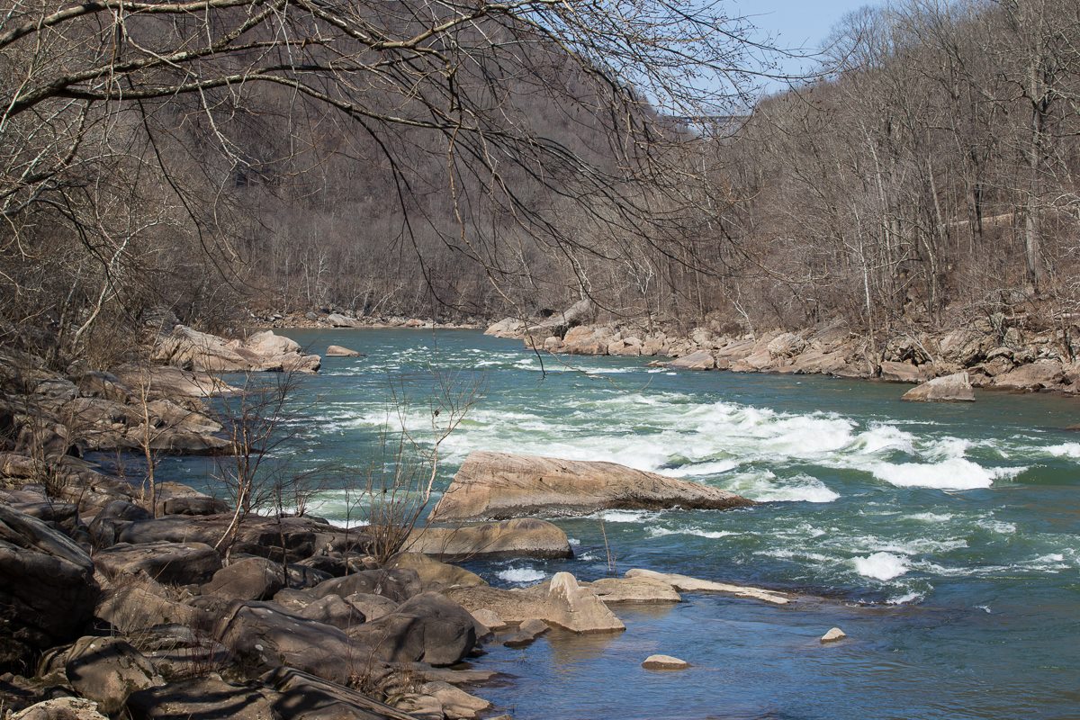
View of Gorge Bridge from New River in West Virginia I was lost at the bottom of the Kaymoor Mining Trail the other day by straying from the path. I was at the bottom of the mountain, and would have to backtrack by climbing two steep slopes and rediscovering the old Kaymoor coal mine ruins toward the 844 steps that I would have to ascend in order to get to the rest of the trail which led to my car. Considering this, I decided I could spare an hour lost on the river before work. Taken 3/21/2014


Hi! Have been busy planning and preparing for a road trip coming up. Today I took this photo on the way to Charleston. It was a beautiful day and the featured scene here shows how nice the clouds were. This photo above was taken at 4:06pm, and because it's closer to Charleston, the elevation's lower than in Beckley, and it gets warmer quicker, allowing the noticeable effects of Spring to arrive sooner. Maybe once I get back from the trip, Beckley will look like this.... As always, feel free to recommend places to photograph. Happy Spring!!!

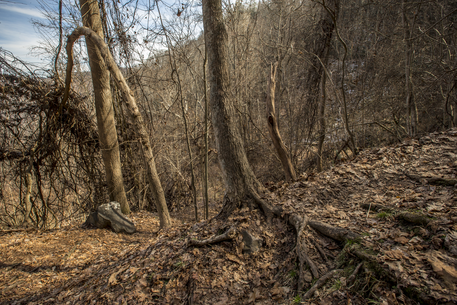
Expanding on the stairs of Kaymoor, if you are not yet a master of stairs or haven't evolved mountain calves, then the Kaymoor Mining Steps in Fayetteville/Lansing, West Virginia, will help you get there. After talking about the trail with people who live around here, I learned that some people choose to go up and down it a few times weekly for exercise. Going down isn't so terrible, but walking back up is a challenge. I recommend keeping hydrated during your hike down and up, and to brace yourself so you can enjoy the historically significant experience. Below, I will provide a few pictures to give you a better sense of the number of steps to descend and ascend so that you know what to expect in the case that you want to go for it.
From the top:
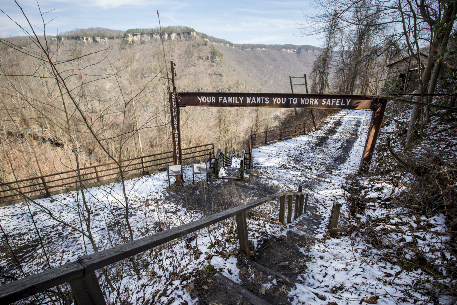
 This is the very top which introduces you to the history of Kaymoor Miner's Trail. From here you go down a path leading through rocks, down beside a waterfall, and through more of a dirt trail, as shown below.


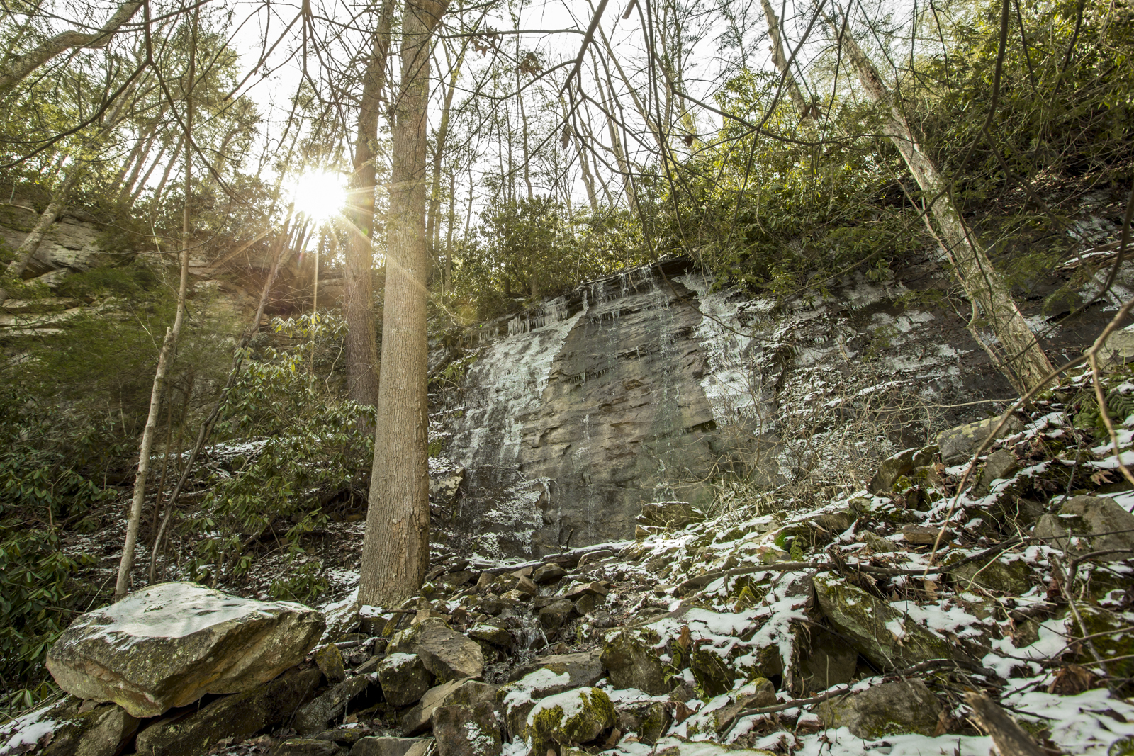 Be careful when it's cold out because the ice on the rocks is slippery. If you slip on an icy rock, you might fall off a cliff and die.
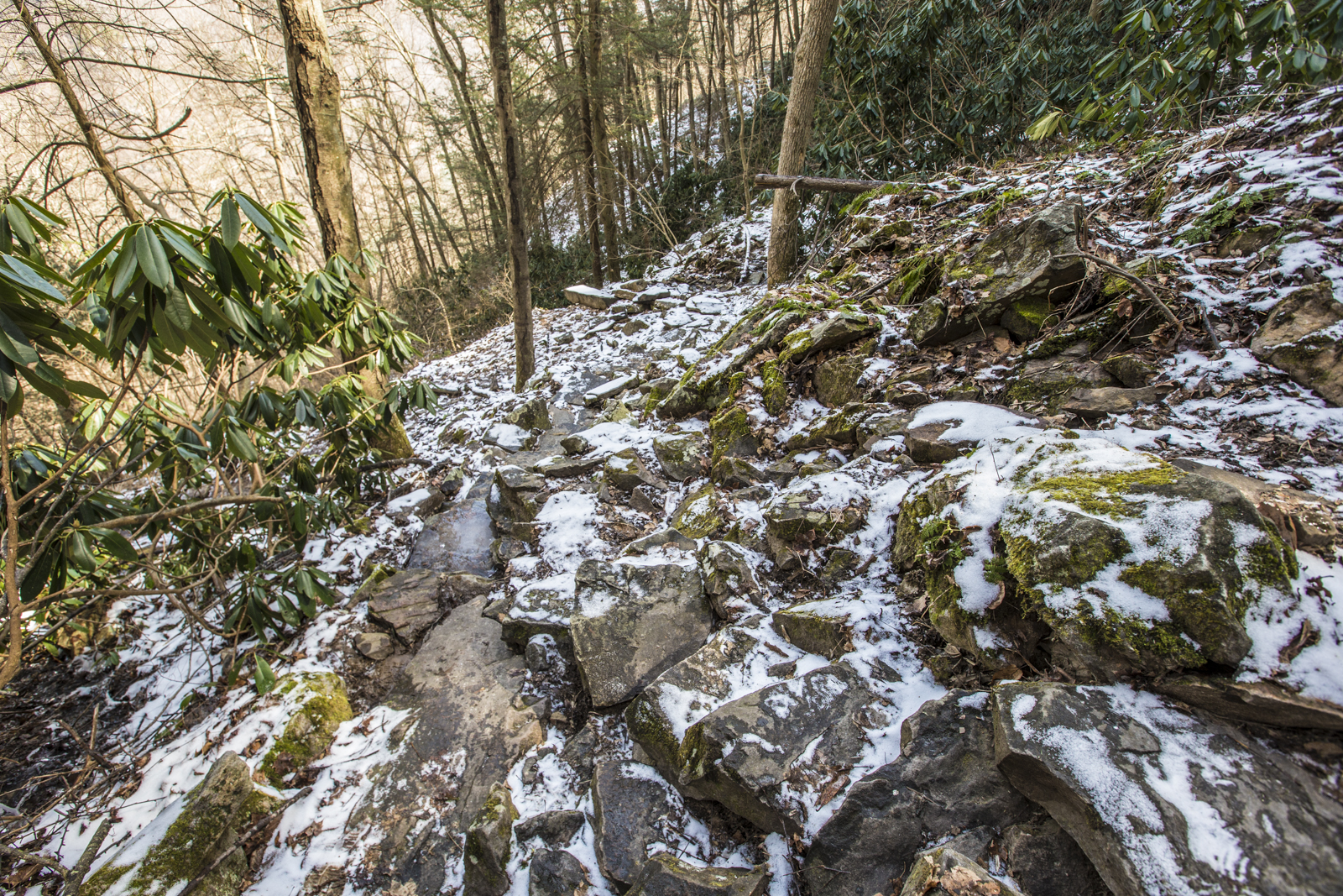 From there, continue down the narrow path...

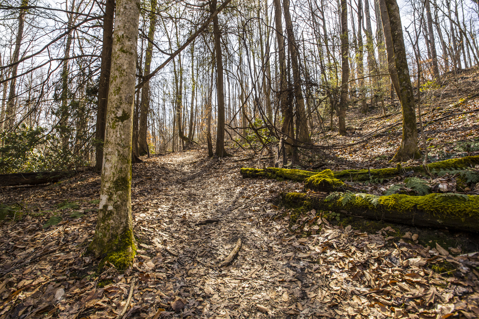
 Finally you'll arrive at this point and turn around to see the beginning of the steps, as shown below.
 Here's the top of Kaymoor Bottom, shown below:
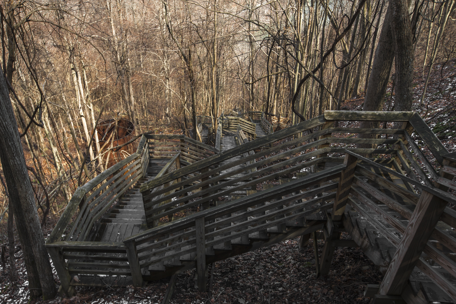
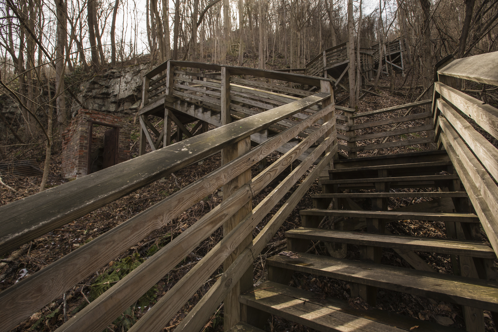
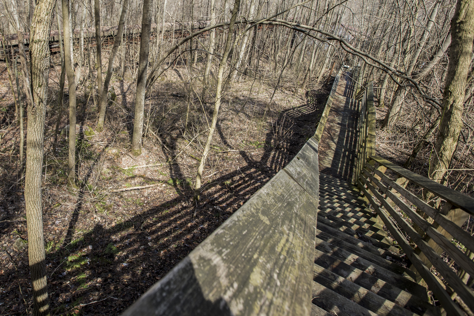
 From there, once you've reached the bottom of that straight series of steps, you'll come to these windy steps.
 You can see the rails where the rail cars used to haul townspeople (Kaymoor Number One miners and their families) up and down the mountain. That is also the next windy passage before this long straightaway below.
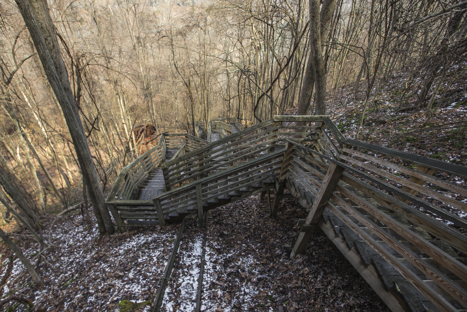
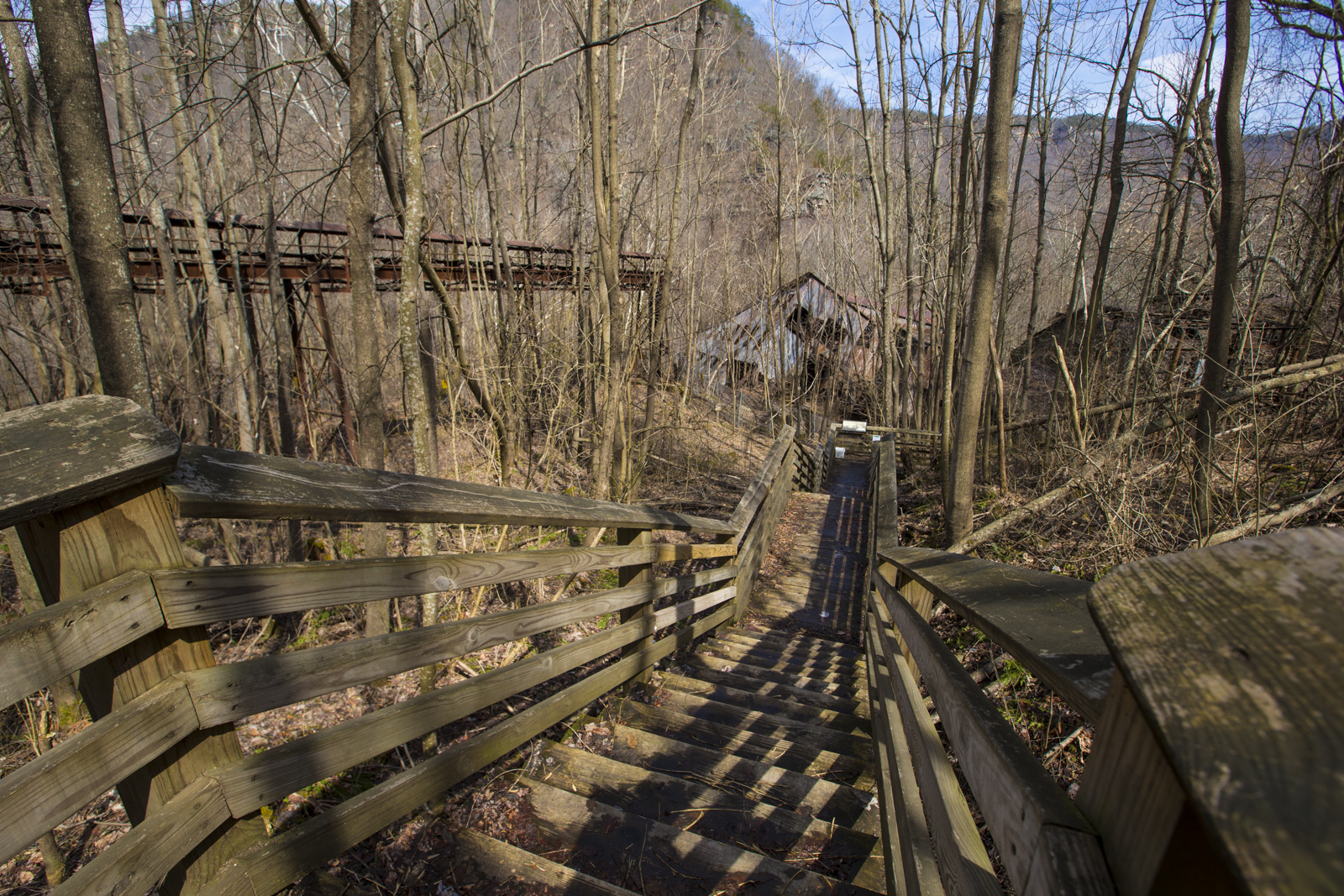
 You see at the end there that the passage stops. From there, you'll go around another quick windy turn, down and around to the final descending series of steps. Here is a view from the top of that final descent:
 As you can see, it drops down farther into the abyss. I'll show a photograph of the final descent which highlights form a bit better with shadows along the left side of the steps.
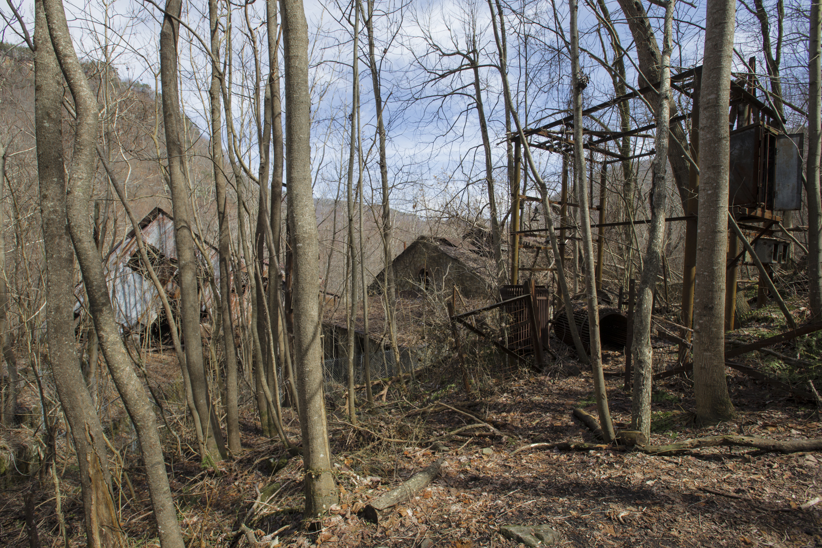
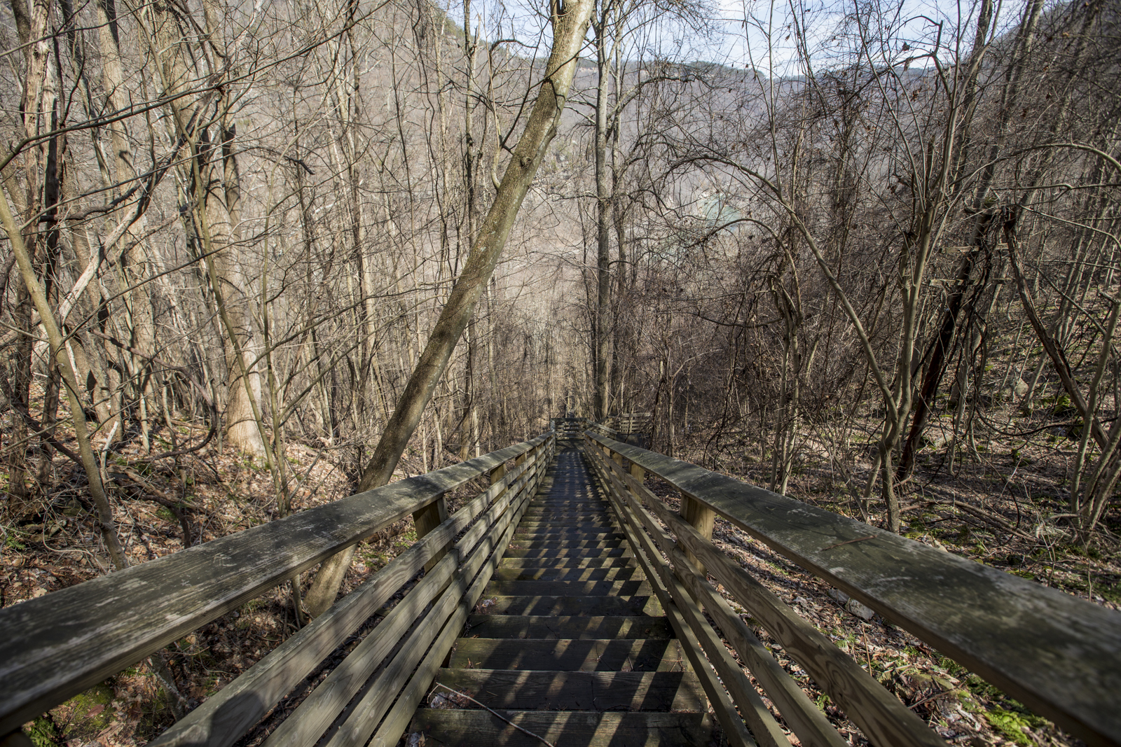
 There you have it. It just keeps going on and on until you get here, your destination of Kaymoor ruins.
 That's it for the descent. Can you imagine falling down any of those straight series of steps? Luckily the steps are so close together that you might roll more than tumble if you fall just right. More on the abandoned buildings later.
As always, offer travel suggestions in the comments below. I like to photograph landscapes, city-scapes, nature and wildlife photography, old abandoned buildings and other areas involving human-altered scenarios.
[contact-form][contact-field label='Name' type='name' required='1'/][contact-field label='Email' type='email' required='1'/][contact-field label='Website' type='url'/][contact-field label='Comment' type='textarea' required='1'/][/contact-form]

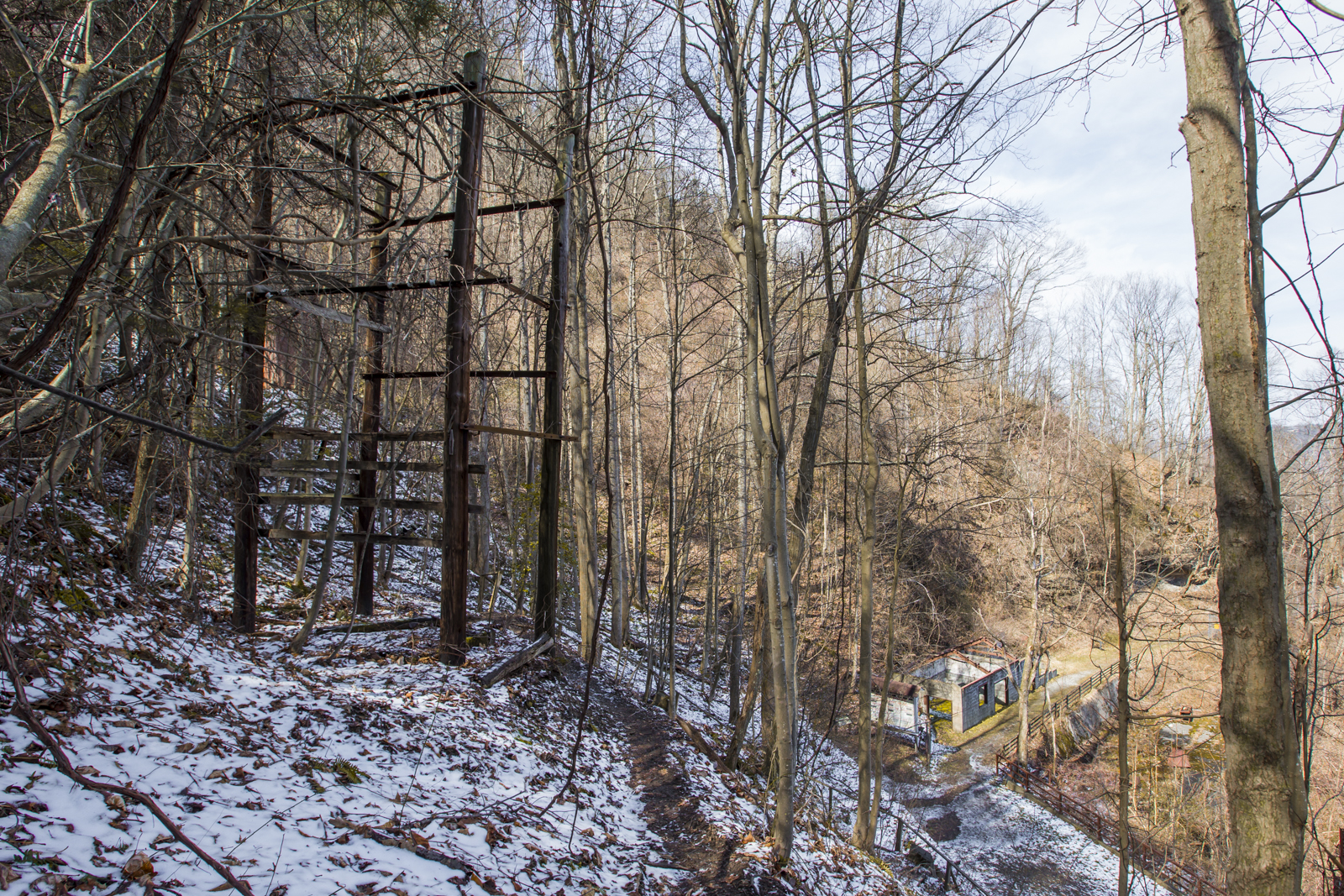
Kaymoor is an abandoned town in West Virginia that once housed coal miners and their families who worked at Kaymoor "Number One Mine", which operated from 1899-1962. This is an historic/cultural preservation reserve. During the 1900s, thousands of migrants from England, Ireland, Wales, Italy, Eastern Europe and the Southern United States immigrated to work in the mines here at what was once a bustling town. Below Kaymoor Top are the 800 steps leading to ruins of what was once a bustling coal operation with numbers of coke ovens used to make coke from coal. Coke is a fuel produced by baking coal in an oven under a regulated flow of air. Impurities burn away, leavining only high-carbon coke, which burns hotter than coal. Coke was used extensively to fuel iron furnaces. The Kaymoor mines were originally opened to supply coal to product coke to fuel the furnaces of the Low Moor Iron Company of Virginia.
Friday I said I'd post more Florida images, but then had a decent trip to Kaymoor Miner's Trail, so have been posting on that instead. Apparently there is an old abandoned miner's town at the very bottom, next to the river. I find the above photo interesting that the lines in it zigzag about the image and mainly down the center, with nearly all overlapping. The staircase leading down the mountain is the beginning of the main Kaymoor Top stair head. By showing the steps and the upcoming elevation changes from my current standpoint at the time (1503.3 ft altitude) versus the altitude of Kaymoor Bottom (709.3 ft altitude), you can get a sense of how steep a walk this is, and that you need to brace yourself as you walk it down.
 The photo above is at Kaymoor Bottom, and these buildings are the remains of Kaymoor's coal processing plant and power station. You'll find various coke ovens and other industrial remains wildly disbursed throughout the area. The town had died by the 1950s and the remains of old coke ovens and other signs of humanity were burnt in a fire that occurred in 1960.

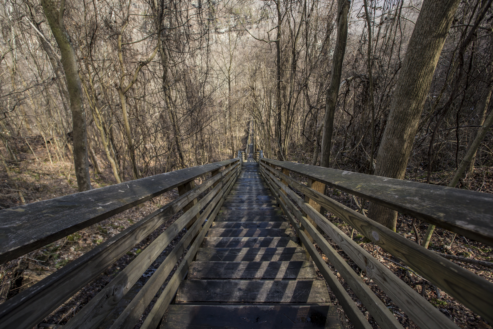
 This staircase is known as the boardwalk. In the past, there was also a haulage cart available that would transport passengers down more efficiently on rails. It was an electricity-powered haulage cart descended from cables which spanned nearly half a mile up and down the mountain.
This image, and the image below shows the initial trail heading up to the steps. Both were taken on the way back up to the entrance.
This staircase is known as the boardwalk. In the past, there was also a haulage cart available that would transport passengers down more efficiently on rails. It was an electricity-powered haulage cart descended from cables which spanned nearly half a mile up and down the mountain.
This image, and the image below shows the initial trail heading up to the steps. Both were taken on the way back up to the entrance.
All for now. As always, feel free to suggest places for me to visit, study, and document in the future. Happy St. Patrick's Day! [contact-form][contact-field label='Name' type='name' required='1'/][contact-field label='Email' type='email' required='1'/][contact-field label='Website' type='url'/][contact-field label='Comment' type='textarea' required='1'/][/contact-form]

Today's the last day of winter quarter at Savannah College of Art and Design and the next quarter doesn't begin until the 24th, so I look forward to more Photo Excursions and additional photo experimentations during the break. For now, I'll show you more of the exposures I got from this past photo excursion and my experience with photographing the sun.
I'd not really done as much golden hour photos as many photographers had in the past, so I will highlight the nice golden colors you get from that here:
 You'll notice that as the sun gets lower in the sky, the more diffuse shadows become in certain areas, but also there is this dramatic glow that becomes more red as the sun goes down. This image isn't one to sell, but it highlights an important lesson in terms of understanding how color changes over time in terms of natural lighting. That plant is a Sumac, by the way. It's a plant found in the Eastern United States. Apparently it is used as a spice in order to deliver a tart flavor to foods but be careful to avoid picking any poisonous Sumac, because that also exists although it's not as common. The leaves are similar. Anyway, toward nightfallthe sky began to look morered as it lowered below horizon, like so:
This is nightfall, dark blue skies, and a nice jeep. Have a great Friday!

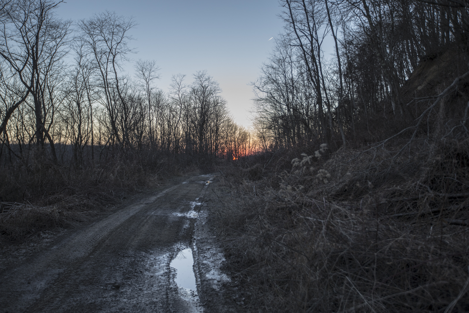
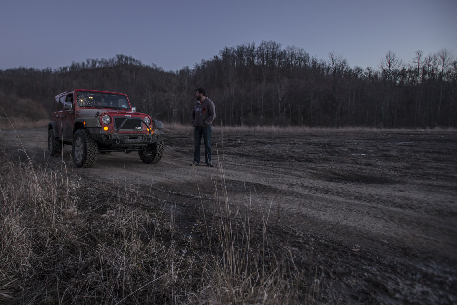
Yesterday I and a few buddies took a jeep out to explore some treacherous terrain around the Cool Ridge to Coal City region of West Virginia, starting out around John Lane Road in Cool Ridge.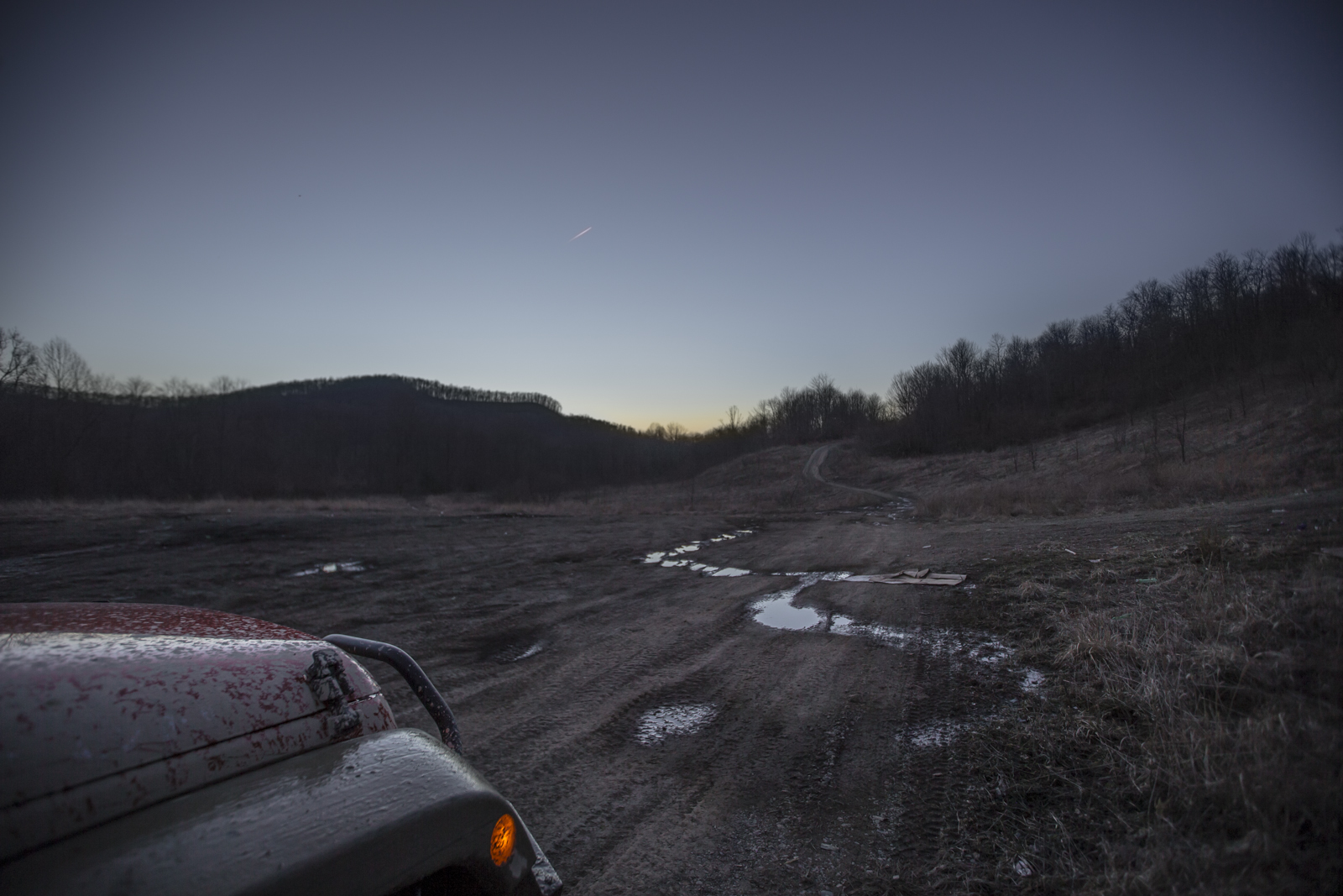
The four of us started out about 4:30 pm and drove on well until after nightfall, so I got the chance to practice with a bit of starry sky photos. I will say, I did not expect to feel so tired from riding in a vehicle, but all the driving through creeks crossing the road and over so many rocks and up and down steep hills was apparently enough to make my muscles ache. At any rate, here's the starry sky.
 I'm not sure exactly where we were here. The GPS didn't work for whatever reason--I'm pretty sure I'd absentmindedly unscrewed it while sitting in the backseat, and I think we were in some part of Cool Ridge.
For the photographers out there.... The ISO was at 12800 so you see a decent bit of luminance noise there, also shot at 0.5 seconds at f/2.8 aperture, so that adds up for a more blurred depth of field but the slower shutter speed did allow the light to blast in better. I would like to try this in the future with and without a three-legged tripod to reduce camera shake (causing the blurry outcome) with lower ISO, (to reduce luminance noise), slower shutter speed, and tighter aperture for greater depth of field... and also without a tripod at a similar ISO to reduce camera shake, slower shutter speed for greater light reading, and tighter aperture (higher f/#) for greater depth of field...although I'm not sure if the greater depth of field will be necessary at dark because the only things that will really come through are the two-tones of shadows against night sky color, and the stars peeking out between the sticks.
Alrighty then, that's enough for today. Tomorrow I plan to write on photographing the sun at golden hour because I got some interesting shots that way as well.

Where are some of your favorite places to visit in West Virginia? Feel free to let me know by writing suggestions in the contact form below.
[contact-form][contact-field label='Name' type='name' required='1'/][contact-field label='Email' type='email' required='1'/][contact-field label='Website' type='url'/][contact-field label='Comment' type='textarea' required='1'/][/contact-form]